 |
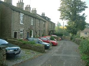
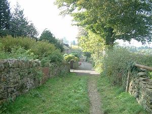
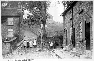
Perched on Kerridge hillside high above ‘old’ Bollington, Cow Lane, (once called Coopers Cow Lane in the 1861 census) Kerridge, affords the most excellent views to the north. It is a very narrow country lane, a cul de sac, with an assortment of properties strung out along its 250m. It ends in the well trodden footpaths that lead around Kerridge Hill. Approach off Lord Street, Chancery Lane. Leads to Adshead Court. Nearest shops – Palmerston Street. Nearest pubs – Church House, Poachers Inn (via Mill Lane) Council Ward – East. It is very likely that the stone cottages in the lane would have been occupied by miners. In the fields off the closed end of the lane (behind the camera in the pictures left) there are the remains of more than a dozen coal pits. These would have been bell pits, very common in this part of Cheshire. There were further pits up the hillside and around the east side of the hill. Coal mining was at one time an important industry in Bollington and Rainow. This area is well known for its paved footpaths, ‘trod’ paths paved with long lines of stone slabs across the fields. It is notable that the paths from the closed end of Cow Lane are not paved which is surprising considering the importance of these paths. The bottom picture is a case of spot the difference. This is the junction of Cow Lane with Chancery Lane and Lord Street. The only obvious difference today is the children’s clothing! Other differences include the crushed stone road surface, the gas lamp, the window shutters, and the size of the tree – that pictured became very large and diseased and had to be felled in 2015. It has been replaced by a new sappling. |
 |
|
 |
Listed structures
See Listed Buildings page for the full list and notes regarding Listed, Article 4, and SPD properties.
The links on the structures are to the Historic England web site. Any links to local history pages are to this web site.
 |
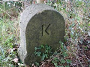
Parish boundary stone; in field hedge east of Cow Lane, early 19thC stone marking junction of boundaries between Bollington, Rainow and Kerridge. Not publicly accessible. |