(and Brookfield View)
 |
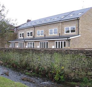
This is a very mixed street with stone cottages and pubs at either end, a couple of large 19thC town houses, several stout 1930s semi-detached brick houses in the middle, plus one 1960s brick bungalow and one modern but very fitting stone cottage built into a very tight corner. A terrace was completed in late 2009, known as Brookfield View, which is five 2.5 story three bedroomed terraced units in natural stone having fine views across Sowcar meadow into trees on the far side of the valley. Approach off the roundabout junction of Shrigley Road, Palmerston Street and Church Street. Leads to Silver Street and Harrop Road, Willow Bank Drive and Foxglove Close, Brookfield View, Mill Lane, Smithy Brow and Blaze Hill, Spuley Lane and Oakenbank Lane. Nearest shops – Palmerston Street Nearest pubs – Poacher’s Inn, Cotton Tree and The Turners in the street; Church House round the corner in Church Street. Viceroy Indian restaurant in the street. Council Ward – East. Around the turn of the 19th/20thC Ingersley Road was known as Up Sowcar, pronounced Sooker. This refers to Sowcar brook and meadow which runs alongside the road. In the 1841 census Ingersley Road was called Sowcar Road. By 1861 it was Sowcar Lane. Finally in 1971 it became Ingersley Road on the census. |
 |
Ingersley Hall
More usually known today as Savio House, this name having been provided by the Catholic Order that presently occupies the property.
Ingersley was the country home and estate of the Gaskell family. It was built by John Gaskell, a member of a successful local farming family, about 1774, before any of the major mills in the town.
| A video from James Hough. It starts by looking up Shrigley Road and pans round to Ingersley Road, then to Church Street, finishing at Palmerston Street. |
Listed structures
See Listed Buildings page for the full list and notes regarding Listed, Article 4, and SPD properties.
The links on the structures are to the Historic England web site. Any links to local history pages are to this web site.
 |
Boundary stone, Ingersley Road |
|
| Parish boundary stone |
||
| Sowcar Farmhouse |
||
| Barn at Sowcar Farm |
||
| Water trough |
||
, Ingerlsey Road") |
Ingerlsey Hall (Savio House) |
|
| Conference Hall at Ingersley Hall |
||
| The Cottage at Savio House |
Conservation
Part of this street is in the Bollington Conservation Area. Numbers 7-13 are subject to Article 4 Direction.